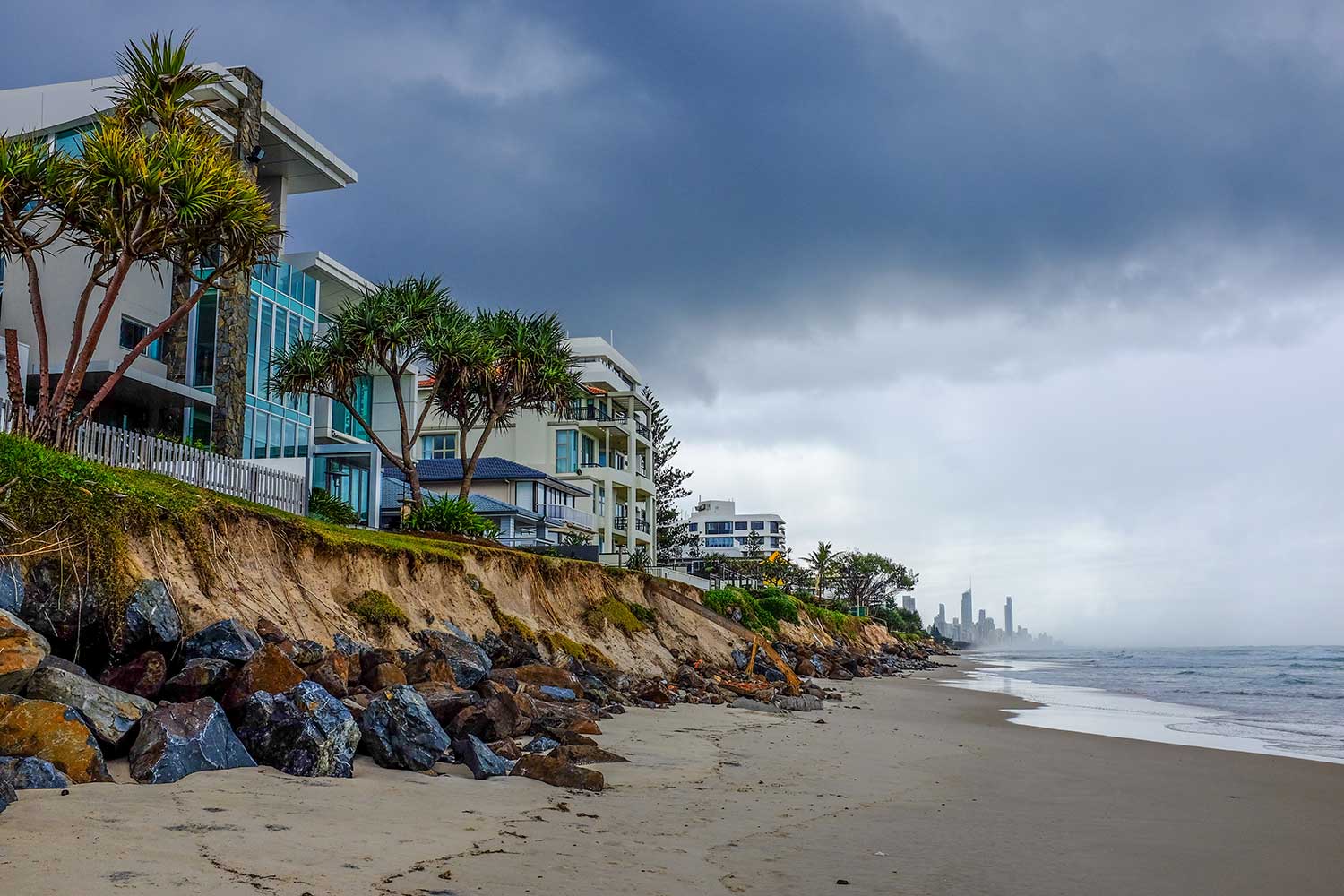
Simply understanding the movements of a dynamic coastal shoreline is a challenge. Trying to engineer solution to ensure pristine beaches for the thriving tourist city of the Gold Coast is a monumental task. Particularly in the last few years where powerful storms have severely scarped and eroded the beaches presenting a significant safety hazard to the community.
This was the issue faced by the City of Gold Coast; how do they manage the coastline, and ensure that the beaches are as healthy as possible?
Fortunately the Griffith Centre for Coastal Management had laid the foundation to solve this problem several years earlier. Professor Roger Tomlinson, the Director of the Centre explains how the collaboration worked.
“The solution stems from collaboration between the Centre, the School of Information and Communication Technology (ICT) and the community infrastructure CoastalCOMS. CoastalCOMS manages a series of fifteen cameras, called Coastalwatch, along the 58kms of the Gold Coast’s coastline regularly used for surfers and beachgoers to check the conditions of the ocean,” Professor Tomlinson explains.
“It is here that we drew upon the expertise of our colleagues in ICT. They were able to use the real-time video feeds and translate the information into usable data to measure how the shoreline changed with every passing tide.”

The research used a series of image recognition algorithms to establish how much data could be derived from the cameras. For instance, without any human intervention could the algorithm establish the size of the waves, how many people on the beach, the type of wave (spilling or dumping) as well as a range of other parameters useful for effective coastal management?
An algorithm that proved highly reliable could detect the difference between wet sand and dry sand, regardless of whether the camera was perched high on a building or low to the ground. Here was a means of automatically establishing where the shoreline is in real-time during daylight hours 365 days a year.
Previously measuring the shoreline required surveyors physically mapping the beach, a time consuming and labour intensive task that required several boats, divers and surveys and could only realistically be conducted once or twice a year.
This new approach to monitoring provided a round-the clock solution that could monitor how the shoreline reacted to a dramatic scarping event and to predict how different beach management methods to fix the beach might compliment natural coastal processes.
From the initial research to establishing a partnership with the City of Gold Coast took five years. Shannon Hunt manages the program for the City, “The coastal imaging program has provided information on how sections of our coastline respond to natural weather events, and also on how successful various beach management projects have been. The information collected is complimented by a hydrographic survey program, and ensures beach management decisions are best practice. The City is very fortunate to have the most comprehensive coastal data collection program for a section of Australian coastline.”

Professor Tomlinson concludes, “This has been and continues to be a great program, based in some really exciting collaborative research that is now assisting the City to make better, more informed decisions about how our coastline is managed. It has been a good result for everyone.”
An algorithm that proved highly reliable could detect the difference between wet sand and dry sand, regardless of whether the camera was perched high on a building or low to the ground. Here was a means of automatically establishing where the shoreline is in real-time during daylight hours 365 days a year.
Previously measuring the shoreline required surveyors physically mapping the beach, a time consuming and labour intensive task that required several boats, divers and surveys and could only realistically be conducted once or twice a year.
Coastal erosion image credit: Cris Barnes