Our team from Griffith University’s Australian Rivers Institute has identified thousands of hectares of rapidly eroding gullies in the rivers that feed fine sediment into the waters of the ailing Great Barrier Reef.
These giant alluvial gullies can be up to tens of hectares in area, each producing tens of thousands of tonnes of sediment to the reef each year.
The good news is that after six years of intensive field work, we can unveil a solution for fixing these gullies and significantly improving the water quality of the reef.
In our rehabilitation pilot study, we have demonstrated that sediment run-off can be reduced by 75 per cent in two years.
The Queensland and Federal Governments have established ambitious targets to improve water quality to the Great Barrier Reef (GBR) over the next decade, with reduction targets of 80 per cent for nutrients and 50 per cent for sediment by 2025.

If such ambitious targets are to be met, it will require precisely targeted remediation of large areas of alluvial gullies in places such as the Normanby and Bowen catchments.
UNESCO and indeed the international community are concerned about the dramatic decline of the reef.
Two of the three main factors driving its 30 per cent loss of coral cover (identified by AIMS) — cyclone frequency and intensity, and ocean warming-induced coral bleaching events — are related to global climate change and are not easily influenced by what we can do on the land.
However, the third factor — crown of thorn starfish outbreaks – is strongly linked to water quality declines. So, short of reversing climate change, building the reef’s resilience by accurately targeting the highest priority water quality problems is effectively the only option.
In recent years an increasing body of research — funded by the Queensland and Federal governments — has pointed to the fact that sources of sediment to the GBR differ to what was thought to be the case.

Research undertaken by our group at Griffith University, and which is backed by similar findings from other groups at the CSIRO and the Queensland Department of Science, Information Technology and Innovation (DSITI), has contributed important new insights into the GBR’s major sediment sources, how to identify where they are, and how we need to begin tackling them.
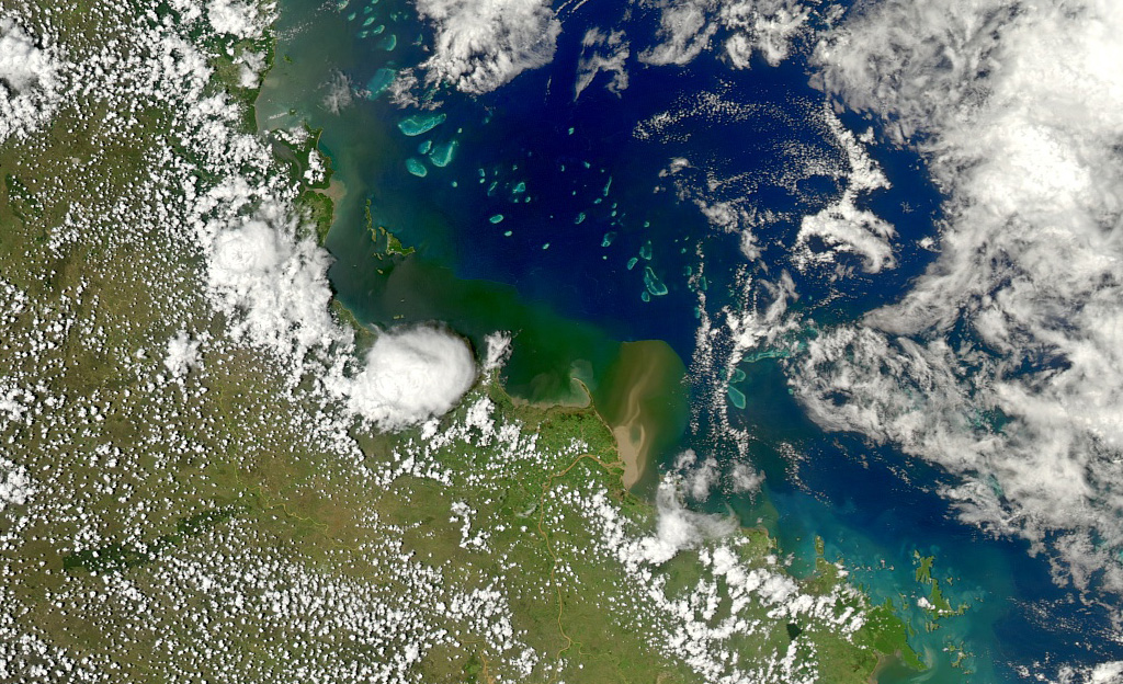
In the Normanby catchment in Cape York, which is the source area for large flood plumes that are affecting the northern part of the GBR, we found that the anthropogenic sediment supply is dominated by gully and channel erosion. Our data shows these processes deliver 2.8 million tonnes or more than 90 per cent of the sediment load into the Normanby River each year, with hillslope erosion contributing less than 10 per cent.
The strength of these findings is that they are supported by multiple lines of evidence.
Of the known anthropogenic sources, gully and channel erosion are by far the most dominant and the ones we are just beginning to address in any systematic way. Similar research in the Burdekin and Fitzroy catchments has also found that terrestrial run-off is dominated by erosion from similar sub-surface processes (gullies, channels and scalds).

If we are to effectively reduce sediment yields from gully erosion sources, it is critical that we fully understand the range of drivers and controls on such gully processes.
Our research has shown that gully erosion comes in two distinct forms — alluvial and hillslope (also known as colluvial) — and each requires a different management approach.
Our team first identified and used the term “alluvial gullies” to characterise this distinct erosion process in the Gulf catchments. When we then looked at the Normanby and Burdekin catchments in the GBR, we saw similar processes.
In both the Gulf and Cape York, we have good data to show gully erosion accelerated at the time cattle and sheep were introduced into these catchments between 1860 and 1880.
Hillslope and alluvial differences
Hillslope gullies, as their name suggests, are erosion features that cut into the depressions on hillsides. They are narrow, linear features that progress up the side of the hill until they run out of material to erode, or the catchment area feeding them becomes so small that there is insufficient run-off to continue driving the erosion process.

In other words, they are self-limiting.
In areas susceptible to this form of gully erosion, such as the goldfields soils in the Burdekin, there are thousands of such gullies in various stages of evolution.
Typical unit gully sediment contributions might be in the range of 1-10 t/ha/yr. However,recent work in this area indicates that many gullies are actually in the waning stages of their development, meaning their sediment yields will probably decline in coming decades if left to their own devices.
Under these circumstances, the management focus should be on ensuring grazing pressure is kept to such a level that they do not accelerate erosion, and that new gullies are not initiated.

Actively managing such gullies is logistically difficult because there are so many spread over such a wide area. Management efforts will need to focus on targeting the subset of active gullies that are still in the early phase of their evolution.
The only way such information can be efficiently gathered at large scales is to collect airborne LiDAR data (laser survey) every few years to track the rate of progress of individual gullies.
The structure and behaviour of alluvial gullies are completely different. These gullies are confined to the alluvial flats adjacent to the main river channels and tend to be much more expansive, typically forming single gully complexes that feed large volumes of fine sediment directly into the main river channels draining to the reef.
Such gully complexes are typically between 10-30ha in size and might produce 3,500-10,000 tonnes of sediment per gully complex; even more in some instances.
Alluvial gullies like this are more like point sources than distributed diffuse sources, and the evidence from those we have monitored in detail is that they will continue eroding at roughly equivalent rates for several hundred years at least.
In other words, at effective management timescales, these alluvial gullies are not self-limiting. Instead, they will simply keep producing large volumes of sediment to the reef … unless we intervene.
In many respects a large alluvial gully complex is like a mine site with no tailings dam or environmental controls of any kind.
In a large catchment like the Burdekin, there may only be several hundred large alluvial gully complexes, yet collectively they produce a significant proportion of the total sediment load delivered to the reef.
Clearly, if we are to improve reef water quality and increase the reef’s chances of survival, alluvial gullies will have to be tackled.
Where are the main hotspots?
Monitoring data derived from the period 2005-2009 demonstrates that the Burdekin River contributed around 6.8 million tonnes of fine sediment to the GBR lagoon per annum. This is equivalent to a line of dump trucks parked end to end from Sydney to Perth and back again.
This has been estimated to represent 47 per cent of the total contribution to the entire lagoon. Of this, around 65 per cent is derived from the combined contributions from the Bowen and Bogie Rivers, with the vast bulk derived from the Bowen River.
Hence these two rivers alone contribute around 30 per cent of the total sediment load delivered to the entire GBR lagoon. Furthermore, we know that the Bowen catchment contains some of the highest concentrations of alluvial gullies in all of the GBR catchments.
From what we know about the Normanby catchment in Cape York — where we have an extensive data set – it is clear that alluvial gullies are the dominant land-use driven source of sediment to the northern GBR.
Based on satellite and aerial reconnaissance surveys, this process is also likely to dominate in the critical Burdekin catchment. In terms of their size and degree of erosion, the alluvial gullies in the Bowen catchment are an order of magnitude worse than those in the Normanby.
Is there a solution?
The good news from the Normanby work is that we now have well developed methods for mapping and measuring the rates of alluvial and hillslope gully erosion. These enable us to precisely locate the key erosion hotspots in each catchment.
In the Normanby catchment, we have been able to map all alluvial gullies and thus determine the relative contribution to the total sediment load down to the scale of individual gullies.
The cost of this analysis was around $0.30 per ha and it allows us to effectively target our management efforts to where they will have the greatest impact.
To that end, the approach developed in the Normanby can be strategically rolled out over key sub-catchments in the other large GBR catchments, such as the Burdekin and Fitzroy.
We have also undertaken the first pilot study focused on how we can go about reducing sediment run-off from the most active large alluvial gully complexes. The results are extremely encouraging, indicating that we can reduce sediment yields by 75 per cent of their untreated rates within 1-2 years at a cost of around $30,000 per hectare.
If effectively targeted to the relatively small number of large alluvial gully complexes, it is well within the scope of the resources currently available for managing GBR water quality to treat a significant proportion of these gullies and meet the ambitious government targets.
Intensive approaches such as those trialled would need to be part of a comprehensive strategy tailored to individual gullies and which can be determined once the baseline data is acquired.
With economies of scale, we should also be able to reduce unit costs to significantly less than those from the pilot study.
However, what is clear from these existing trials is that, given the scale of the alluvial gully sources in particular, the scope of this problem has grown way beyond being managed by individual farmers and graziers.
These are a legacy of the past 100-150 years of land use. Furthermore, if we leave this problem to already cash-strapped graziers, it will always be put in the too-hard basket.
The benefits that will flow from the intensive, precisely targeted management of alluvial gullies are largely a public benefit for the downstream ecosystems and ultimately the Great Barrier Reef.
In other words, this is a problem we have to tackle collectively, rather than yet again loading all responsibility upon the already overburdened shoulders of our farmers and graziers.
Presentation: GBR-alluvial gullies


“In both the Gulf and Cape York, we have good data to show gully erosion…”
Having a read of this so-called ‘good data’, vis, “Land-use change from indigenous management to cattle grazing initiates the gullying of alluvial soils in northern Australia” – I see this reference “…nowhere in either Liechardt (1847) or Gilbert (1845) were the terms erosion, bare, stripped, de-vegetated, dissected, unstable, incision, headcut, scarp, drop off, breakaway, badland, or wasteland used to describe the soil surface, gullies, hollows, or creeks.”
NO, the terms Leichardt used were more like this from his journal entry of May 1st, 1845: “…we passed a singularly broken country, in which the waters rushing down from a slightly inclined table land, had hollowed out large broad gullies in a sandy loam and iron ochre, … We met with grass lately burnt, and some still burning, which indicated the presence of natives…”
More wasted taxpayer dollars going to ‘agenda’ research.